
"Geography for Middle School(中等地理)" is a textbook, published by a Korean company 以文社 in Daegu(大邱) city and probably handwritten and printed by some kind of mimeograph machine. We don't know when it was exactly printed, but it should be after 1945, the year Korea gained the Independence. The book also tells that the author is the Association of Gyeongbuk Geographers(慶北地理學會). 慶北 is the abbreviation for
Gyeongsangbuk-do (
North Gyeongsang Province:慶尚北道).
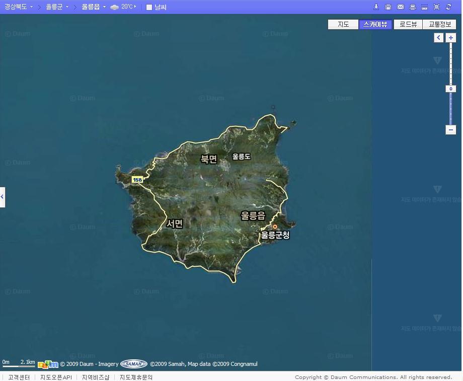
Ulleung County(鬱陵郡), which Ulleungdo and "Dokdo" supposed to belong to, is in 慶北, and Geographer in 慶北 should have been well informed about geography of Ulleungdo.
 中等地理
中等地理序説
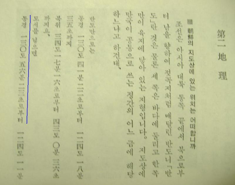
朝鮮의四極●度経度
極東
東経一三〇度五六分(
●陵島東端)
極西 西経一二四度一一分(鴨緑江薪島西端)
極南 北緯三三度六分(済洲島南端) 極北 北緯四三度(咸鏡北道北端)
--------------------------------------
Geography for Middle SchoolPreface
Joseon's quadrupolar, latitudes and longitudes
The Far East
130°56" east (
The eastern edge of Ulleungdo)
The Far West 124°11" west (The western edge of Sindo,Yalu River)
The Far South 33°6" (The southern edge of Jeju island) The Far North 43° north (North end of North Hamgyŏng)
As you may have noticed, the longitude of Takeshima/Liancourt Rocks/Dokdo is
131°52′0″E, and it completely outside of
130°56" E. In other words, from this documents it is crystal clear that Korean Geographers considered that "Dokdo" is not Ulleungdo's adjunct island at all, since it is Ulleungdo's neighbouring island of
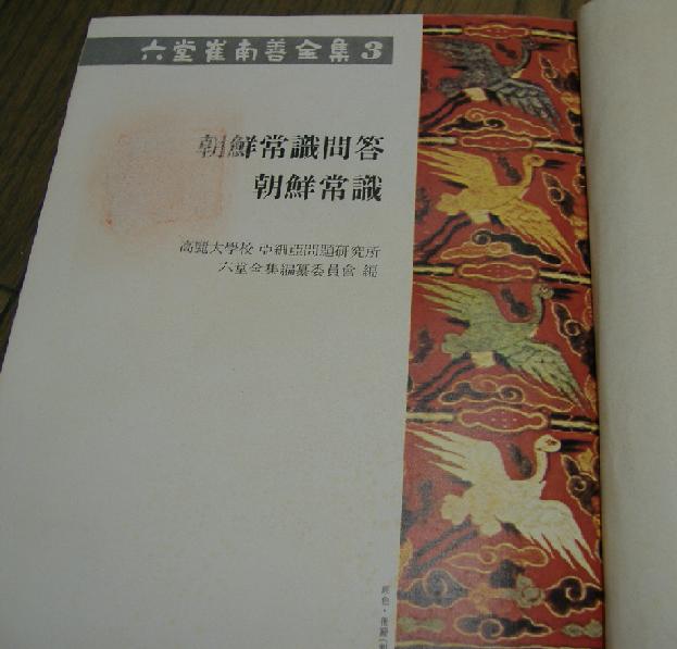
Jukdo(竹島), which locates 130°56" E, not Japanese Takeshima(竹島). This fact coincides with the description of famous Korean geographer and historian Choi Nam-seon(崔南善)'s book entitled, “Common Questions and Answers about Joseon(朝鮮常識問答)” (1946).
 “Question: Where is our country located on a map?”
“Answer: The peninsula, itself, is located from an east longitude of 130 degrees, 41 minutes, 22 seconds to 124 degrees, 18 minutes, 35 seconds, and from a north latitude of 34 degrees, 14 minutes, 16 seconds to 43 degrees, 0 minutes, 36 seconds. If islands (large and small) are included, east longitude is from 130 degrees, 56 minutes, 23 seconds to 124 degrees, 11 minutes, 00 seconds, and north latitude is from 33 degrees, 6 minutes, 40 seconds to 43 degrees, 0 minutes, 36 seconds.”
Mr. Choi also wrote the following in his 1948 book "朝鮮常識":
 “Question: Where are the farthest north, south, east, west boundaries of our country?”
“Answer: On the peninsula, the farthest eastern point is Noseo-myeon, in Gyeongheun County of North Hamgyeong Province. The farthermost western point is Yongcheon-myeon, in Yongcheon Country of North Pyeongan Province. The farthest southern point is Songji-myeon, in Haenam County of South Jeolla Province. The farthest northern point is Yupo-myeon, in Eunseong County of North Hamgyeong Province.”
“If islands are included, the fartest eastern point is Jukdo, in Ulleung County of North Gyeongsang Province. The farthest western point is Ma-an-ri, Sindo-myeon, in Yongcheon County of North Pyeongan Province. The farthest southern point is
Marado, Daejeong-myeon, in Jejudo of South Jeolla Province. The farthest northern point is Yupo-myeon, in Eunseong County of North Hamgyeong Province.”
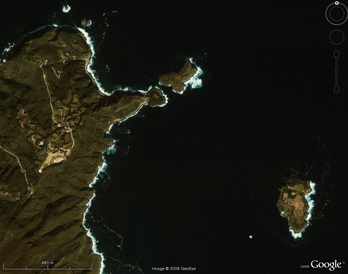
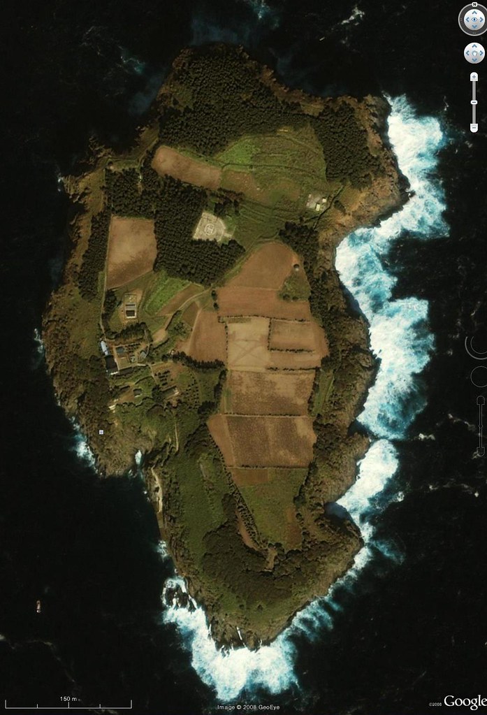
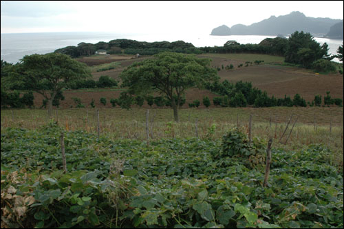
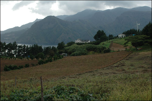
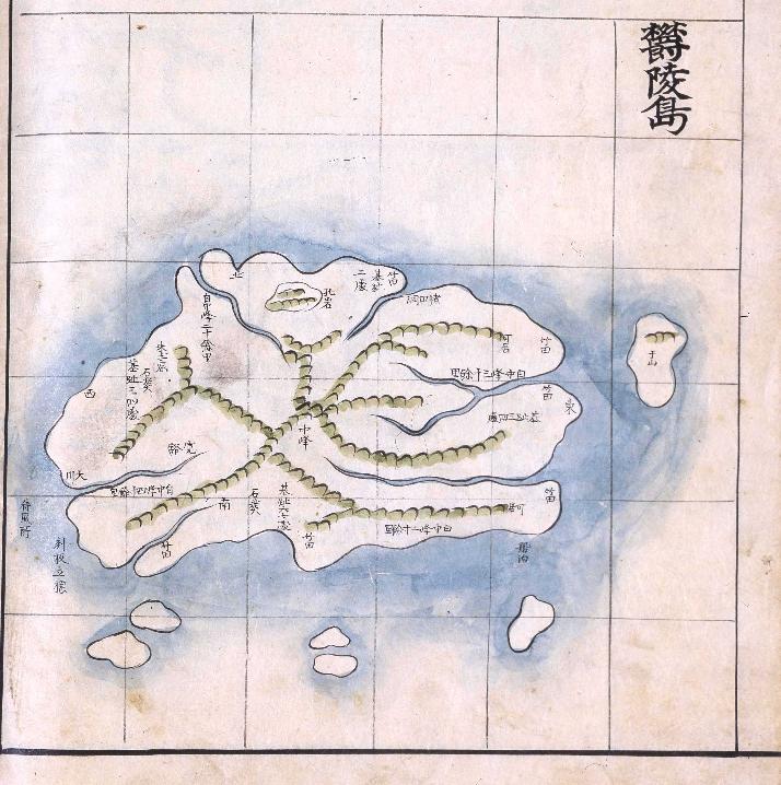
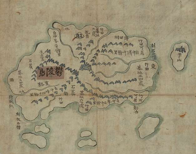
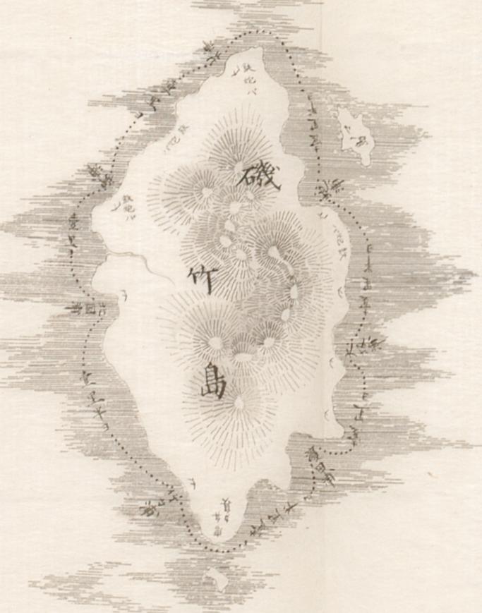
Mr. Choi clearly wrote that Korea’s farthermost eastern point was “Jukdo, in Ulleung County of North Gyeongsang Province.” As can be seen on the modern map of Ulleungdo above, Jukdo is a small island about two kilometers off Ulleungdo’s east shore. (Images of Choi's books are from reprinted book.)
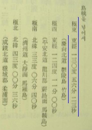
極東 東経一三〇度五六分二三秒
(慶尚北道鬱陵島竹島)
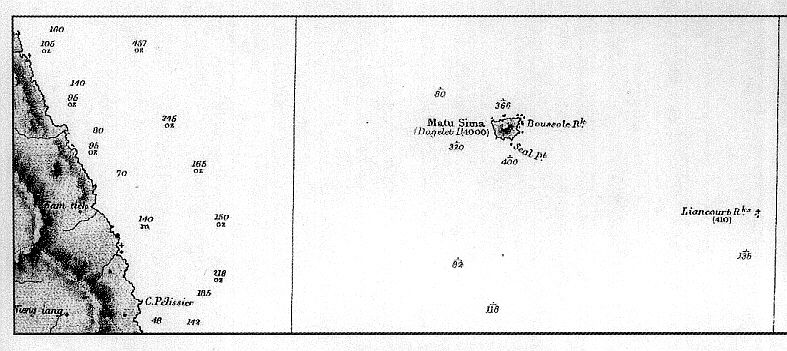
This 竹島 is not Japanese Takeshima/Liancourt Rocks/Dokdo, but Jukdo. When Japanese got confused the numbers, names and locations of the islands in the Sea of Japan due to the misplotted Western maps and old Korean maps which placed Usando to the west of Ulleungdo after the Meiji Restoration in 1867, the government of Japan sent Warship Amagi to survey Ulleungdo and "finally came to understand the situation when I (Kitazawa, a MOFA official ) learned that
"Matsushima" (松島) was Ulleungdo, and the other island, which was called Takeshima (竹島), was just a rock (竹嶼 - Jukdo or Boussole Rock). " Then the islands was decided to call "竹嶼(Korean name 竹島:Jukdo)" by Japanese in 1882, and Korean followed Japanese and started to call this neighbouring island of 4km away from Ulleungdo, which they used to call Usando, as Jukdo(竹島). Korean considered the easternmost of Ulleungdo, which naturally makes the island Jukdo the easternmost of Korean territory. In spite of the confusion in 1860s-80s,
Japanese officials knew "ホルネットロックス/ホウルリロック : Hornet Rocks " or "リャンコ島 : Liancourt Rocks", today's Japanese Takeshima, is Japan's while they never ever considered as Korean territory.
As we could see in the following references, there is no single document that suggests Korean government and intellectuals even perceived accurately where their "Dokdo" is nor had a clear conception that it was their territory before 1950s, when they militarily occupied the island illegaly against Japan's official firm protest.
The book is owned by the anonymous individual in Shimane. He/She gave me a permission to post it only after Takeshima Day in Feb.
References ;
Lies, Half-truths, and Dokdo Video, Part 11 : 大韓全図(1899), 大韓新地誌(1907), 崔南善「朝鮮常識問答」(1946) 「朝鮮常識」(1948)
1900 - The Times Map (China and Japan, Printing House, London)**It shows Ulleungdo = Korean , Liancourt Rocks = Japanese
1901 - "Daehanjiji" (大韓地誌) Map of Korea's Gangwon Province (玄采)
1906 - "Daehan Jiji" (大韓地誌) by Hyeon Chae (玄采)
1907 - "Chodeung Daehan Jiji" (初等大韓地誌)1907 June - "Sinpyeon Daehan Jiri" (新編 大韓地理)1907 - Daehan Shinjiji Attached Maps (大韓新地志附地圖)
1922 - "Map of Daehanminguk" (대한민국 디도) (大韓民国図)
1954 - Korean map didn't include Liancourt Rocks " Korea: Her History and Culture" Office of Public Information, Republic of Korea"Korean Eastern limits described in various books world wide exclude Takeshima/Dokdo from Korean TerritorySugino Yomei's blog page "
★ハングルで書かれた「朝鮮の東端」" (Japanese)
 But I recently found another version of the same map. It was from "Hammond's Atlas of The World" (C.S. Hammond & Co. N.Y. 1904).
 Please take a look at another map from the same atlas, the map of "China, Japan and Korea". (Please look at the left map) [Click the map to enlarge]
 By the way, the subtitle of the atlas reads "A New Series of Physical, Political and Historical Maps Compiled from Government Surveys and Exhibiting the Latest Results of Geographical Research - Accompanied by an Index-Gazetteer of the Principal Towns of the World".


