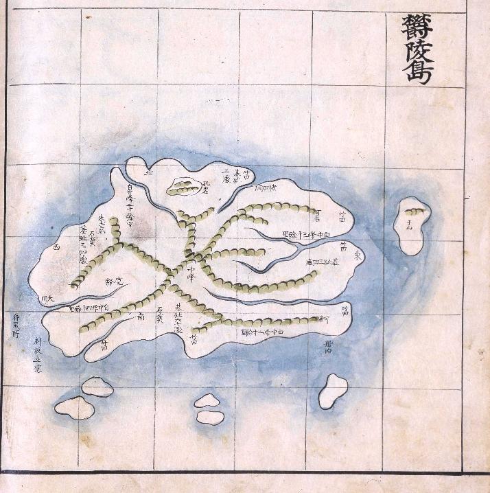
Ulleungdo (울릉도 - 鬱陵島)

Ulleungdo's Northeast Shore (울릉도 동북 지역) & Jukdo (죽도 - 竹島)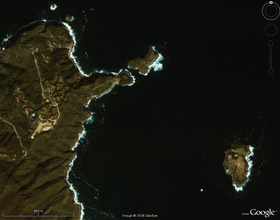
Ulleungdo's Neighboring Island of Jukdo (죽도 - 竹島)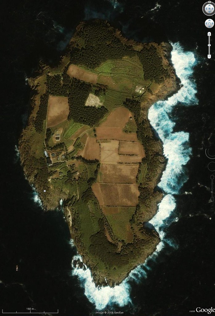
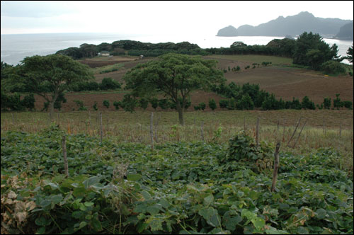
On Jukdo (죽도 - 竹島) looking toward Ulleungdo to the west (Ohmynews)
Compare the shape and location of Jukdo (竹島 - 죽도) from Google's satellite photo with the shape and location of the neighboring island labeled as "Usan" (于山 - 우산) on some of Korea's old maps of Ulleungdo (鬱陵島 - 울릉도):
"Haedong Yeojido" (海東輿地圖) - Ulleungdo (울릉도 - 鬱陵島) ca. 1776 - 1795
"Dong Yeodo" (東輿圖) - Ulleungdo (울릉도 - 鬱陵島), 1795 - 1800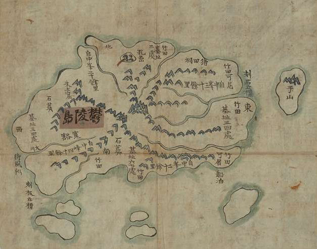
"Joseon-do" (朝鮮圖) - Ulleungdo (울릉도 - 鬱陵島), 1800 - 1822 
Cheonggu-do (靑邱圖) - Ulleungdo (鬱陵島 - 울릉도) 1834

On the above Cheonggu-do (靑邱圖) map of Ulleungdo, the hash marks along the edge of the map represented distances of 10 ri, which was four kilometers and sometimes seem to have represented two kilometers. Ulleungdo's neighboring island of Jukdo is about two kilometers off its east shore. Liancourt Rocks (Dokdo / Takeshima), on the other hand, is about 92 kilometers southeast of Ulleungdo, which means the neighboring island labeled as "Usan" (于山 - 우산) on the above maps could not have been Dokdo (獨島 - 독도).
The following is the satellite photo of Ulleungdo's neighboring island of Jukdo overlayed with an image of the island labeled as "Usan" (于山) on the 1834 Cheonggu-do (靑邱圖) map.

This comment has been removed by the author.
ReplyDeleteSee No.4 photo
ReplyDeletewhere have mountain sign on each Usando maps.
See this video and you can understand Jukdo's geography which have small mountain on north.
It is completley match with yabutarou's claim against Hosaka's theory.
http://outdoor.geocities.jp/yabutarou01/a/newpage2.html